Related
Confiscation Military Order Targets Lands in Rantis Village / Ramallah Governorate
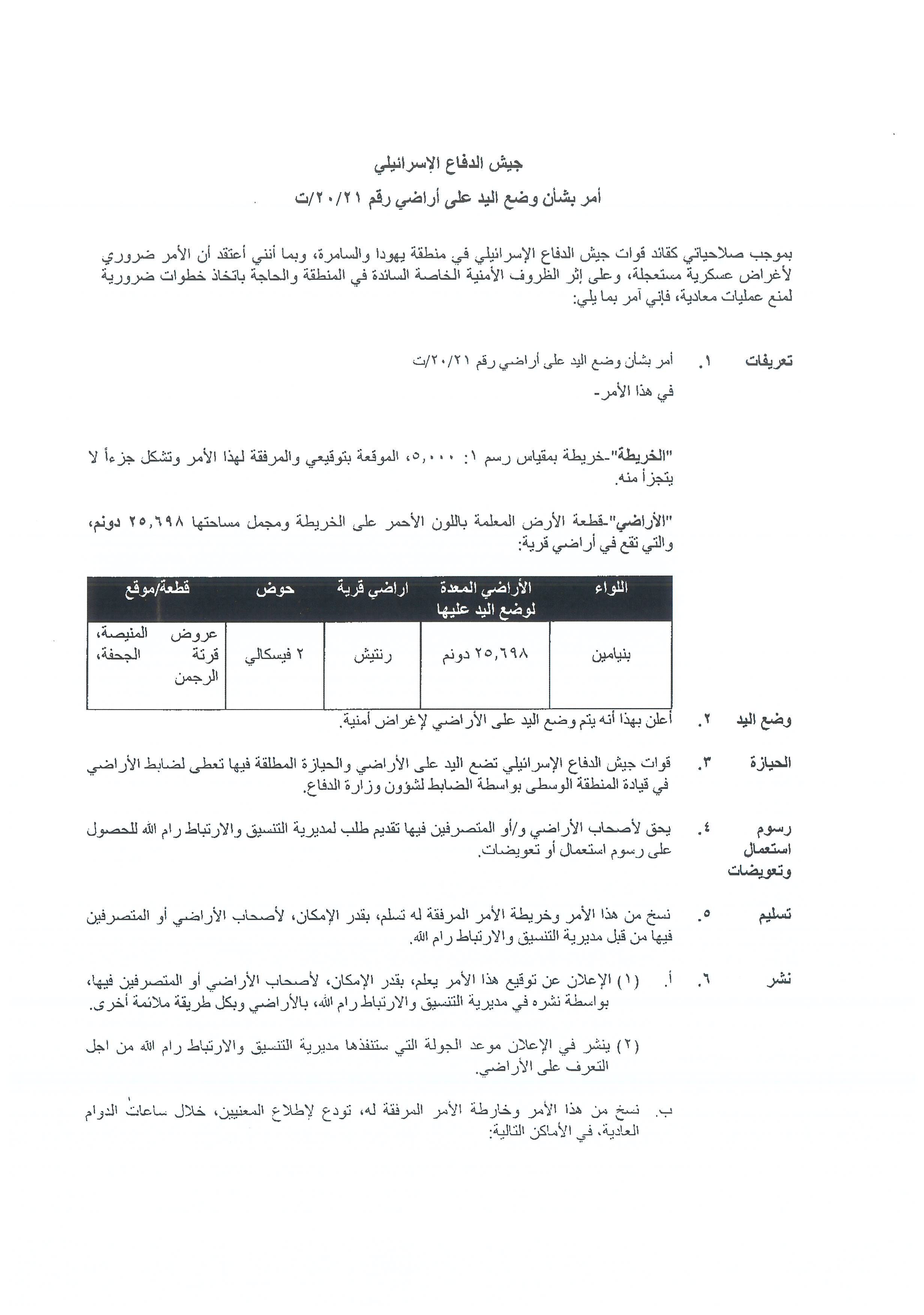
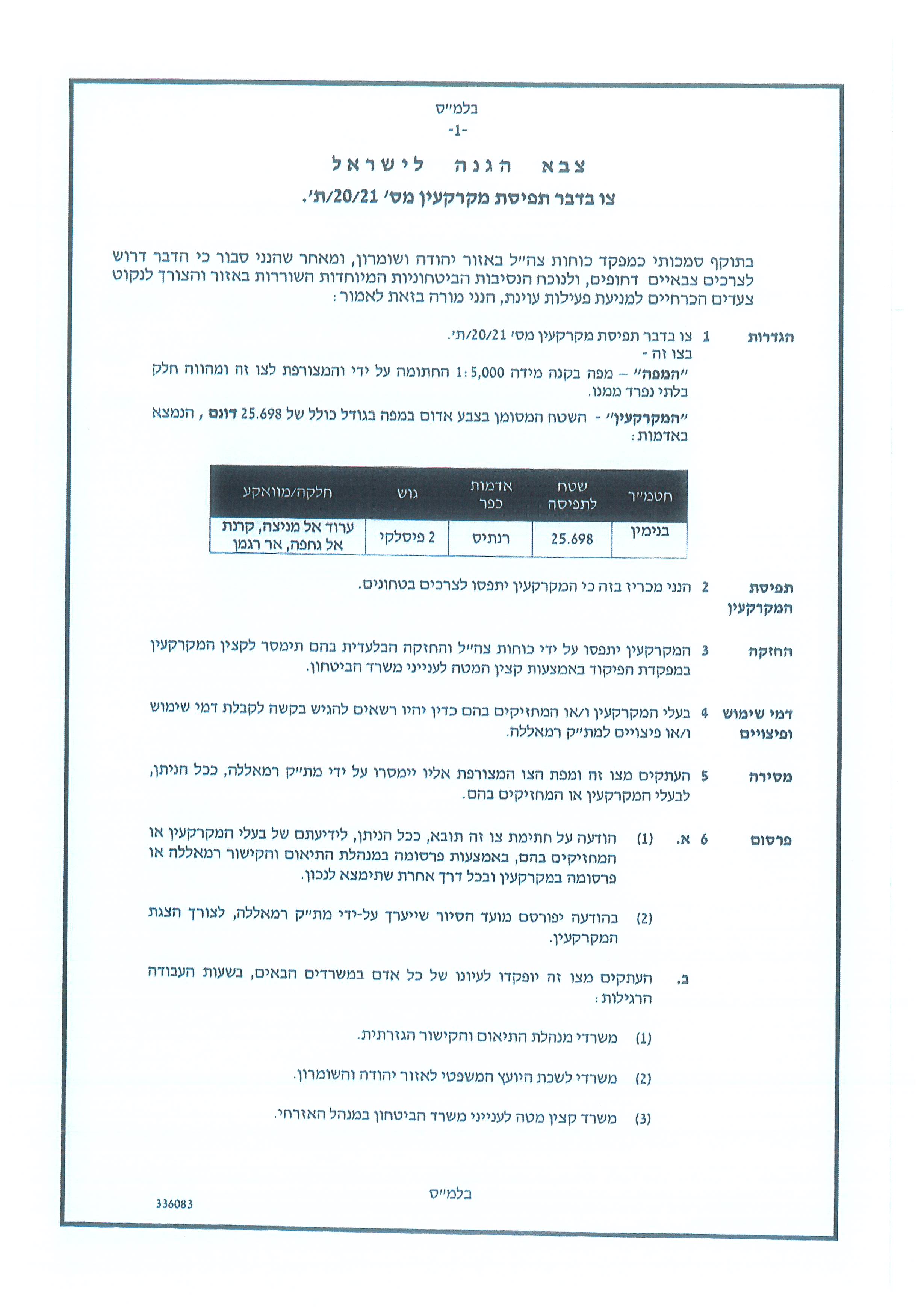
Violation: Confiscation Notice for 25.6 dunums.
Location: Rantis village / Ramallah Governorate.
Date: October 31st 2021.
Perpetrators: The Israeli Occupation Forces.
Victims: People of Rantis village.
Description:
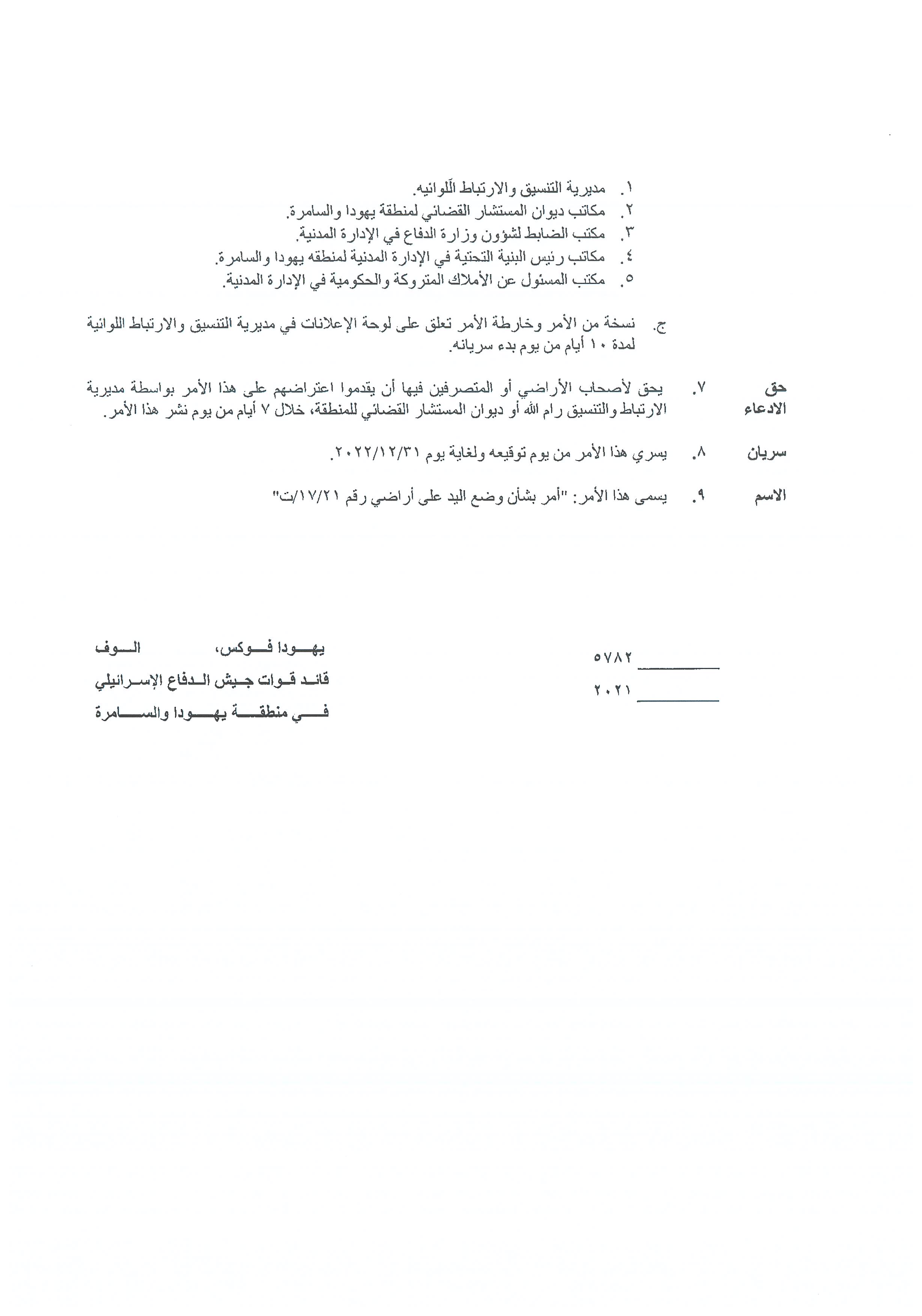
Sunday morning, October 31st 2021, Israeli Army Commander in the West Bank Yehuda Fuchs issued military order number (t/20/21), under which the occupation confiscates a plot for security purposes, the targeted area covers 25.6 dunums of Rantis village lands northwest Ramallah.
According to the military order, the targeted location is in natural block 2 of ‘Oroud Al-Manisa , Qarnet Aj-Jahfa , and Ar-Rajman area of the village lands , blocked by the Annexation and Expansion Wall west the village.
Rantis village council head Hassan Wahdan told LRC:
“The targeted lands are blocked behind the Annexation and Expansion Wall west the village since 2000 and the occupation is prohibiting farmers and landowners from using their own lands. Only few meters ago, the occupation established a military base, as expected, the confiscated land is meant to serve the military camp, especially that the occupation forces, are already conducting trainings at the plot.”
The targeted facilities belong to Wahdan and Ar-Ryahi families from the village, and the area is currently empty, but used to be planted with a variety of crops in the past.
Photos 1-4: Lands targeted in military order (t / 20/21)
Rantis town:[1]
The town of Rantis is located 35 km northwest of Ramallah, bordered on the north by the village of Al -Liban Al Gharbi, on the west by the the Green Line, on the east by Al- Liban Al Gharbi, and on the south by Shuqba. Its total population is 3179 people, according to the census of 2017. Its total area is 10,780 dunums, of which 647 dunums are a built-up area of the village.
Since the Israeli military occupation of the West Bank in 1967, Rantis’s land has been under constant confiscation as followed:
218 dunams were seized to build the bypass road No. 465 connecting Israeli settlements with Israel;
414 dunums were confiscated for the construction of the Apartheid wall, and 1616 dunums were isolated behind it.
The land of Rantis is classified according to the Oslo Agreement as followed:
- Areas classified as B – 1,328 dunums.
- Areas classified as C -9,452 dunums.
There are also a number of small old villages (Khirbets) around the mother town of Rantis that indicate the ancient character and authenticity of the area. They include the following: ‘Deir Alla, Barish, Khirbet Mesmar, Deir Degla, Al-Dur, Al-Ras, the shrine of Saad and Saeed and the shrine of Arbaeen.
The town of Rantis is inhabited by the following families: Khalaf, Hadan, Ballout, Riahi, and Abu Salim.
[1] GIS-LRC

This Publication has been produced with the assistance of the EU
The Contents of this publication are the sole responsibility of the individual organization only , and can in no way be taken to reflect the views of the EU


