Related
Israeli Civil Administration demolishes a residence in Al-Eizariya Bedouin community of Jabal Al-Baba
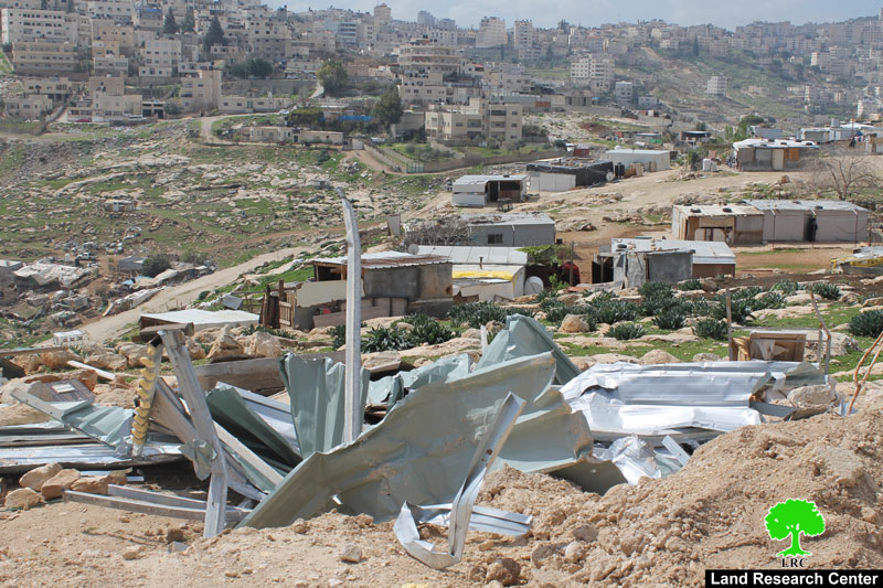
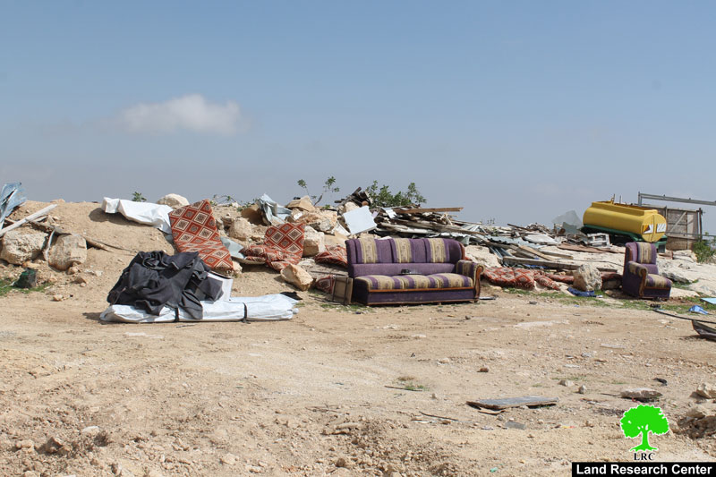
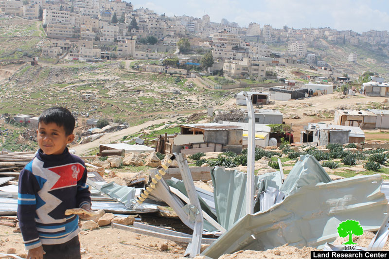
The bulldozers of Israeli Occupation Army demolished on February 20, 2018 a residence in Jabal Al-Baba Bedouin community, which is threatened of evacuation via the so- called E1replacement plan.
Reportedly, a massive force from Israel Border Police, two bulldozers and army troopers raided the community in the early morning and demolished the house of citizen Hani Abu Ouwaida without any previous warning.
The demolished residence is a residential barrack with a total area of 100 m2. Thirteen family member including ten children lived in the house.
Jabal Al-Baba: Closed military zone:
The Israeli Occupation Forces claim structures founded in the community of Jabal Al-Baba as built in "closed military zone" . It should be marked that the community witnessed many demolition operations and displacement plans. Noteworthy, the occupation has been recently confiscating structures donated by the EU on feeble and illegal pretexts and claims. The act of providing humanitarian aid to such areas is now considered illegal by the occupation.
The E1 plan:
It should be marked that the Israeli occupation authorities have been working to relocate Bedouins from Jabal Al-Baba to implement the so-called E1 plan that aims at building hundreds of colonial units to accommodate new colonists.
About Jabal Al-Baba:
The community is inhabited by 56 families (300 members) all hailing from the area of Beir Al-Saba'. Those Bedouins were displaced in the aftermath of 1948 war.
Jabal Al-Baba is edged by Al-Eizariya town from the west, Al- Za'ayyem town from the north, Maale Adummim colony from east and Wad Al-Jimal community from the south.
The community has a total built-up of 27 dunums. Primary and secondary school students of the community study in Al-Eizariya schools that are 2km far in distance; they go to schools on feet.
Most roads of the community are agricultural and unpaved.
This case study is part of Kan'aan Project