Related
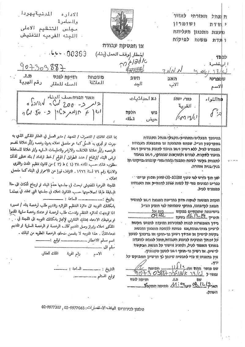
Halt of work notice targets a Greenhouse in Wad Rahal / Bethlehem governorate
Violation: halt of work notice targets a greenhouse.
Date: December 8th 2019.
Perpetrators: The Israeli Occupation Civil Administration.
Victims: Anwar Al-Fawaghra.
Description:
Sunday December 8th 2019, A massive army force raided Wad Rahal and gave citizen Anwar Fawaghra a halt of work notice on his greenhouse in An-Nahla area, on the pretext of building without licenses.
The Occupation Authorities ordered the immediate stoppage of construction works, and the subcommittee will decide the fate of the structure in their session - Dec 16th at Beit El military court.
An-Nahla area in Wad Rahal is a hotspot for Israeli Human Rights violations and settlers’ assaults, Israeli settlers have expansionist schemes for the area, and in order to get rid of the lands’ indigenous people, they carry out daily tours in An-Nahla and harass Palestinian farmers.
Khallet An-Nahla is surround be several Bethlehem villages, most of them are affected by settlers violence, and in case settlers grabbed the land and annexed it with Tuqu’ illegal settlement (not to be mistaken to the Palestinian village of Taqu’) , people of the area will be in danger and face arbitrary measurement from the Israeli government for the sake of settlers’ security.
The following table shows more information about the targeted facilities:
name | Family members | children | Notice number | notes |
Anwar Al-Fawaghra | 6 | 4 | 00369 | Agricultural structure |
Halt of work notice targeting a greenhouse
About Wad Rahal:[1]
12 km south Bethlehem city, Rahal is bordered by Irtas (north), Wadi Al –Nes “Efrat settlement” (west), Janatah and Hindaza (east) and “Al-Ma’asara (south).
Wad Rahal is populated (1819) people in 2017 census.
The town has a total area of 4,131 dunums, 173 dunums are the town’s built up area.
The bypass road (1,235 m) devoured under its route about (123) dunums and blocked (142) dunums.
Oslo accords divided the town as the following:
- B area (1,710) dunums.
- C area (2,421) dunums.

This report was prepared with the financial support of EU
The contents of this document are the sole responsibility of LRC and do not reflect EU positions
[1] GIS-LRC


